![](/images/other/stat-length.png)
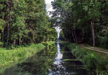
![Trail On foot Neumarkt in der Oberpfalz - Lengenbachtalweg - Photo](https://media.geolcdn.com/t/1900/400/13540ee5-7460-4bac-a978-11ddf2e7ecff.jpeg&format=pjpeg&maxdim=2)
Lengenbachtalweg
SityTrail - itinéraires balisés pédestres
Tous les sentiers balisés d’Europe GUIDE+
![Length](/images/other/stat-length.png)
Length
10.2 km
![Max alt](https://static1.geolcdn.com/siteimages/upload/files/1508320355ic_sort_altitude_max_24dp.png)
Max alt
579 m
![Uphill gradient](https://static1.geolcdn.com/siteimages/upload/files/1508320355ic_sort_den_pos_24dp.png)
Uphill gradient
169 m
![Km-Effort](/images/other/stat-length.png)
Km-Effort
12.7 km
![Min alt](https://static1.geolcdn.com/siteimages/upload/files/1508320355ic_sort_altitude_min_24dp.png)
Min alt
459 m
![Downhill gradient](https://static1.geolcdn.com/siteimages/upload/files/1508320355ic_sort_den_neg_24dp.png)
Downhill gradient
258 m
![Boucle](https://static1.geolcdn.com/siteimages/upload/files/16400158638029165_repeat_loop_refresh_sync_direction_icon.png)
Boucle
No
Signpost
Creation date :
2022-02-11 12:46:58.662
Updated on :
2022-02-11 12:46:58.662
![On foot](https://static1.geolcdn.com/sitytour/trail-icons/100.png)
2h53
Difficulty : Easy
![Scan this QR Code to open this trail in the SityTrail application](https://capi.geolives.com/qq0zvz2zws4bq2lad0pu/sitytour/trails/3087854/qr.png?size=200)
FREE GPS app for hiking
About
Trail On foot of 10.2 km to be discovered at Bavaria, Landkreis Neumarkt in der Oberpfalz, Neumarkt in der Oberpfalz. This trail is proposed by SityTrail - itinéraires balisés pédestres.
Description
Trail created by nicht bekannt.
abgeschlossen (Jan 2013 by cycling_zno)
Symbol: Weiße 6 auf grünem Grund
Positioning
Country:
Germany
Region :
Bavaria
Department/Province :
Landkreis Neumarkt in der Oberpfalz
Municipality :
Neumarkt in der Oberpfalz
Location:
Unknown
Start:(Dec)
Start:(UTM)
681803 ; 5460792 (32U) N.
Comments
Trails nearby
![Trail On foot Sengenthal - Ölkuchenmühle – Winnberg - Photo](https://media.geolcdn.com/t/375/260/b4112e19-8bba-4c6d-948b-f5a31c95abd2.jpeg&format=jpg&maxdim=2)
![On foot On foot](https://static1.geolcdn.com/sitytour/trail-icons/100.png)
Ölkuchenmühle – Winnberg
On foot
Easy
Sengenthal,
Bavaria,
Landkreis Neumarkt in der Oberpfalz,
Germany
![](/images/other/stat-length.png)
6 km | 7.1 km-effort
1h 36min
![](https://static1.geolcdn.com/siteimages/upload/files/16400158638029165_repeat_loop_refresh_sync_direction_icon.png)
No
![Trail On foot Sengenthal - Ölkuchenmühle - Kanalschleuse 29 - Photo](https://media.geolcdn.com/t/375/260/4a964d81-f42b-416c-a13f-fcff1ca37b53.jpeg&format=jpg&maxdim=2)
![On foot On foot](https://static1.geolcdn.com/sitytour/trail-icons/100.png)
Ölkuchenmühle - Kanalschleuse 29
On foot
Easy
Sengenthal,
Bavaria,
Landkreis Neumarkt in der Oberpfalz,
Germany
![](/images/other/stat-length.png)
8.3 km | 9.3 km-effort
2h 7min
![](https://static1.geolcdn.com/siteimages/upload/files/16400158638029165_repeat_loop_refresh_sync_direction_icon.png)
No
![Trail On foot Neumarkt in der Oberpfalz - Steinbergrundweg - Photo](https://media.geolcdn.com/t/375/260/14183403-5978-4e91-8d98-1195450f91e0.jpeg&format=jpg&maxdim=2)
![On foot On foot](https://static1.geolcdn.com/sitytour/trail-icons/100.png)
Steinbergrundweg
On foot
Easy
Neumarkt in der Oberpfalz,
Bavaria,
Landkreis Neumarkt in der Oberpfalz,
Germany
![](/images/other/stat-length.png)
6.4 km | 8.6 km-effort
1h 57min
![](https://static1.geolcdn.com/siteimages/upload/files/16400158638029165_repeat_loop_refresh_sync_direction_icon.png)
Yes
![Trail On foot Pilsach - Große Pelchenhofener Runde - Photo](https://media.geolcdn.com/t/375/260/172c34f2-fb8d-4370-8cc4-1256fa1cc327.jpeg&format=jpg&maxdim=2)
![On foot On foot](https://static1.geolcdn.com/sitytour/trail-icons/100.png)
Große Pelchenhofener Runde
On foot
Medium
Pilsach,
Bavaria,
Landkreis Neumarkt in der Oberpfalz,
Germany
![](/images/other/stat-length.png)
16.2 km | 21 km-effort
4h 39min
![](https://static1.geolcdn.com/siteimages/upload/files/16400158638029165_repeat_loop_refresh_sync_direction_icon.png)
Yes
![Trail On foot Pilsach - Rundweg Pilsach – Bodenhof - Photo](https://media.geolcdn.com/t/375/260/d5b570bb-9ba9-402e-98b6-b5d6524b5acc.jpeg&format=jpg&maxdim=2)
![On foot On foot](https://static1.geolcdn.com/sitytour/trail-icons/100.png)
Rundweg Pilsach – Bodenhof
On foot
Easy
Pilsach,
Bavaria,
Landkreis Neumarkt in der Oberpfalz,
Germany
![](/images/other/stat-length.png)
7.6 km | 10.1 km-effort
2h 17min
![](https://static1.geolcdn.com/siteimages/upload/files/16400158638029165_repeat_loop_refresh_sync_direction_icon.png)
No
![Trail On foot Neumarkt in der Oberpfalz - Rundweg Pilsach – Bodenmühle - Photo](https://media.geolcdn.com/t/375/260/d5b570bb-9ba9-402e-98b6-b5d6524b5acc.jpeg&format=jpg&maxdim=2)
![On foot On foot](https://static1.geolcdn.com/sitytour/trail-icons/100.png)
Rundweg Pilsach – Bodenmühle
On foot
Easy
Neumarkt in der Oberpfalz,
Bavaria,
Landkreis Neumarkt in der Oberpfalz,
Germany
![](/images/other/stat-length.png)
7 km | 8.5 km-effort
1h 55min
![](https://static1.geolcdn.com/siteimages/upload/files/16400158638029165_repeat_loop_refresh_sync_direction_icon.png)
Yes
![Trail On foot Neumarkt in der Oberpfalz - Rundweg Labersricht - Photo](https://media.geolcdn.com/t/375/260/c6d01d6b-be47-4e57-a55a-8df0d848528a.jpeg&format=jpg&maxdim=2)
![On foot On foot](https://static1.geolcdn.com/sitytour/trail-icons/100.png)
Rundweg Labersricht
On foot
Easy
Neumarkt in der Oberpfalz,
Bavaria,
Landkreis Neumarkt in der Oberpfalz,
Germany
![](/images/other/stat-length.png)
6.5 km | 8.5 km-effort
1h 55min
![](https://static1.geolcdn.com/siteimages/upload/files/16400158638029165_repeat_loop_refresh_sync_direction_icon.png)
Yes
![Trail On foot Sengenthal - Judenweg - Photo](https://media.geolcdn.com/t/375/260/b4112e19-8bba-4c6d-948b-f5a31c95abd2.jpeg&format=jpg&maxdim=2)
![On foot On foot](https://static1.geolcdn.com/sitytour/trail-icons/100.png)
Judenweg
On foot
Easy
Sengenthal,
Bavaria,
Landkreis Neumarkt in der Oberpfalz,
Germany
![](/images/other/stat-length.png)
4.2 km | 4.8 km-effort
1h 5min
![](https://static1.geolcdn.com/siteimages/upload/files/16400158638029165_repeat_loop_refresh_sync_direction_icon.png)
No
![Trail On foot Deining - Jurasteig Mariahilfschlaufe - Photo](https://media.geolcdn.com/t/375/260/e858b2a9-0487-405f-a408-d035e3789c2b.jpeg&format=jpg&maxdim=2)
![On foot On foot](https://static1.geolcdn.com/sitytour/trail-icons/100.png)
Jurasteig Mariahilfschlaufe
On foot
Easy
Deining,
Bavaria,
Landkreis Neumarkt in der Oberpfalz,
Germany
![](/images/other/stat-length.png)
13.4 km | 18 km-effort
4h 5min
![](https://static1.geolcdn.com/siteimages/upload/files/16400158638029165_repeat_loop_refresh_sync_direction_icon.png)
Yes